"Could I have this dance for the rest of my life?" - Anne Murray

Monday, April 28, 2014

A Peak Week at Zion (and more)


This past week Rick and I had the pleasure of hosting a couple of good friends from back East and giving them the grand tour of everything we love about this area. We've known Steve since our contra dancing days in Greenfield, MA (almost 20 years ago! Eek!) and now we know his wife Wendy since they were married a few years back. They arrived on Monday and it was a whirlwind of activity until they left early Saturday morning. We loved every minute.  

We started their tour of the area with an overview of Zion provided by a shuttle ride through the canyon with stops and hikes as we were so inspired. We got really lucky and snagged the first row of seats in the second half of the two part shuttle bus. The view was so much better than any other seat in the shuttle. So much of Zion is about looking up and if you're not in these four seats, all you see is the ceiling. 

(Oops. Sorry Rick)
Out first stop was the end of the line, the Temple of Sinewava and the Riverside Walk down to the mouth of the Narrows.  It was early in the day so the canyon wasn't too crowded and we could walk at a leisurely pace.  (On other occasions this hike has felt like rush hour in Chicago.)


The Virgin River flowing through Zion Canyon

The Virgin River


Looking up from the floor of Zion Canyon

After a picnic lunch along the river we boarded the shuttle and headed back toward the Visitor's Center. It was a very windy day, so our stops ended up being kind of brief. We had been protected from the wind in the narrower end of the canyon, so we hadn't noticed it before.  

Rick, Wendy & Steve in Zion Canyon 

In an effortless group decision we chose to hike the Kayenta trail to the Emerald Ponds trails, and were once again protected from the wind.

Wendy on the Emerald Pools Trail

The hike left us feeling pretty satisfied with the day, and after a short stop at the Human History Museum to see the video, we loaded up in the car and headed back to the RV. Wendy and Steve are staying in one of the three little cabins at Zion River Resort. The day concluded with a nice supper and planning for the next day, which was going to be a long one.

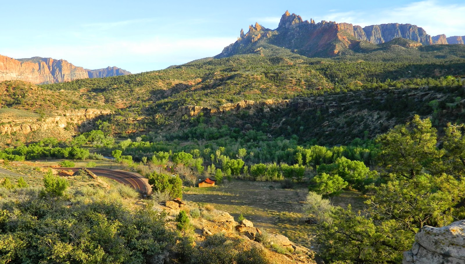
Bright and early the following morning we loaded up the car with a picnic and headed east, up the Zion-Mt. Carmel Highway. The highway hairpins its way up the canyon walls and through a long tunnel that transports you to the east side of Zion - a totally different world.

View of the Zion-Mt. Carmel Highway from Canyon Overlook

We parked immediately after the tunnel in the small lot opposite the trailhead for the Canyon Overlook Trail and headed for the great serendipitous event of the week.

(Quick back story needed here: Before Steve and Wendy left Massachusetts they had san email from a contradance friend who told them that a local New England fiddler, Rachel, was the artist in residence at Zion for the month, and encouraged them to look her up. It wasn't exactly a top priority, but we were open to finding her if the circumstances were right at some point. We actually thought we caught a glimpse of her in the woods as we road the shuttle, and she seemed to be involved in a photo shoot of some sort. She was holding a fiddle - that's how we guessed it was her.)

Flash forward to the Canyon Overlook Trail. About halfway through the hike we turned a corner into a large grotto-like area and who is there but Rachel and a crew of seven photographers, videographers and journalists. We cried "Hey, are you Rachel? We know you (almost)!"

Artist-in-residence Rachel with crew

We discovered she was about to play a waltz while being filmed and we volunteered to provide ourselves as two waltzing couples, right there in the beautiful suspended cave above the canyon. The sound of her fiddle filled the grotto while we waltzed and everyone felt very honored by the moment.

Wendy & Steve recreating the serendipitous waltz after the crowd was gone.

After some more chatting and marveling at our good fortune, we hiked the rest of the way to the Overlook, which was almost as exciting as the serendipitous waltz.

Rick on the Canyon Overlook Trail

Back to the car and we headed east out of the park on Rt. 9, and north to Bryce Canyon NP on Rt. 89. A breathtaking drive from start to finish.

And then Bryce!  We took the scenic drive to the end and picnicked.

The Natural Bridge Arch in Bryce Canyon NP

Overlooking Bryce Canyon

Then we parked back at Sunrise Point and hiked the Queen's Garden Trail.  

Along the Queen's Garden Trail.

Wendy taking an "action shot" of Steve on the trail.
Lenore on the Queen's Garden Trail

The Queen's Garden Trail

Phew! Our return drive got us into Springdale at about 8:00 and we elected to eat at the (historic!) Pioneer Restaurant. Good food, reasonably priced, and a friendly host who gifted us with a 20% coupon for our return visit!

Day three: Rick suggested we go to the least visited parts of Zion: the Kolob Canyons…

Kolob Canyons
... and Kolob Terrace Road to Lava Point. Although these locations are at the north end of the park and geographically very close to one another, they are not connected (except for a dicey dirt road - not recommended), so two separate drives are required. We divided the day with a lunch break back at the RV.

The bird watchers in Kolob Canyon

Kolob Canyon Road and Timber Creek Overlook Trail provided us with some great avian, fauna and flora observations.

s
Spring blossoming in Kolob Canyon

Collared lizard on Timber Creek Overlook Trail

Steve & Wendy at Timber Creek Overlook

Kolob Terrace Road turns north off Rt. 9 very close to Zion River Resort, in Virgin. It's one of our favorite excursions, and like most of Zion, offers new vistas every time you see it, depending on the season, the weather and the hour. The road leads to Lava Point where you can get a great view of Zion Canyon from the north.

View of Zion from Lava Point
There is a campground at Lava Point, but it was closed, so we drove up to the Reservoir to use the facilities that are available there. On the way we stumbled upon some great birding, spotting a flock of red-shafted northern flickers, a few western bluebirds, a spotted towhee, a couple of osprey, and a western kingbird

Aspens near Kolob Reservoir

OMG, we were all sleeping like logs every night, and we hated to see the week end. But come Friday it was time to take Wendy and Steve back to the airport in Las Vegas. None of us is wild about the City of Stars, but we planned to make the best of it. On the way down (another incredible drive, passing through the remarkable Virgin Gorge) we made a detour to the Valley of Fire, a place every bit as amazing as Zion and Bryce, but just a bit smaller.  (Come back for the next post for more on that.)

The plan was to stay overnight in Las Vegas, and the next morning Steve & Wendy would be on a very early flight, and Rick and I would drive back to the RV park in Virgin. After an unfortunate mishap with our hotel reservations (AAA's fault) we found an alternative hotel, got some dinner and tried to chill so we could "enjoy" Las Vegas a bit.  Well, with good company, and a positive outlook, almost anything can be redeemed, and our evening was no exception. Our only goal was to go to the strip and see the Bellagio Fountain, which we succeeded in doing, with pleasure. Top that off with some gelato, and we were ready for bed, but not before fond farewells and promises to do this again sometime, somewhere.

Thanks Wendy & Steve for being part of our best week at Zion ever!

Friday, April 18, 2014

The Chinle Trail: Zion National Park

Continuing with the pursuit of new and adventurous hikes, here is an exploration of the Chinle Trail as far as the foot of Mount Kinesava. Rick is learning the names of the geological formations we are seeing around here, so I'll include a bit of that. Mostly I was just impressed with the beauty and the peace of the places the trail took us.


The trail begins at Anasizi Way, a "private" road on the east side of Rockville, Utah. Coming from the west on Rt. 9, it's an easy left turn to miss, but the real doozy comes at the first right off of Anasazi Way.  There is a sign pointing to the right, indicating the Chinle Trailhead, but there's no way anyone in their right mind would make that turn without knowing what to expect. So the first time I went, I stopped the car, put on the parking break and got out to see if there really was a road and not a cliff there below the hood of the car. Sure enough, there is and you just have to creep over the crest blindly and hope it's there. Trust me and go real slow.


From the parking lot, the trail begins at the information sign and winds it way up a hill, zig-zagging and crossing Anasazi Way again further up. Anasazi Way accesses a beautiful group of adobe homes on what I assume is Anasazi Plateau. (I'll say more about them later.) It also accesses some bike trails on BLM land.


The trail is well marked in some important places, and clear enough as it meanders through the rocks on the edge of the plateau. You just have to pay attention.


You start getting some really good views of the major landmarks of the Zion canyon behind you, and some kind of long views down to the road below.  This first part is all rocky, and I was glad to have my walking stick with me to help with a few scrambly places. Below is a particularly swirly stone wash that the trail criss-crosses for awhile.


After passing all the homes and crossing over the road for the last time, this breath-taking view opens up, with nothing between you and Mount Kinesava.  At this point the mountain itself is still probably a mile or two away.


Along the way you pass an abandoned corral from the time when 
this was still ranch country (before the houses were built here).


Eventually the trail goes almost to the foot of the mountain and you get a good look at what's called  the Chinle Formation, after which this trail is named. It's the purple layer at the bottom. This is one of the few places around where you can actually see the purple Chinle rock.


Although the trail goes on to join the Coal Pits Wash Trail, we decided this was far enough for today.  My goal is to make the Chinle-Coal Pits Wash loop before we leave. (That's a bit over 10 miles, so I'll have to work up to it.) 

The return trip offers more opportunities to see these homes on the plateau. So here's my opportunity to share my enthusiasm about this "pueblo revival" architectural style.  


These homes are grand, million dollar versions of the adobe style house, which in its original form was  modeled after the Native America pueblo home that was needless to say, much more basic.  The style is typically walled with adobe in natural colors, flat roofed, and detailed with rough lumber and log. You can see an authentic pueblo in my post about Taos, NM. But whether grand or not, the style retains a low-profile that blends in with the environment. It's an aesthetic I love.


 While skirting along the edge of the cliffs above Rockville there are additional views of Zion. I think this mountain through the trees is the Watchman.


Here is Eagle Crags in the distance, and Rt. 9 below winding its way through the Virgin River valley, lined with cottonwood trees.


The whole hike, from the trailhead to the first wash under Mt. Kinesava took about 2.5 hours and was "easy" to "moderate."  I've heard that if we had pushed on a bit further we'd have reached the Petrified Forest area. I'd like to see that too, but this was the perfect hike for now. 


Come back for more adventures in beautiful southern Utah. We'll be here for three more weeks. Wishing you a happy Spring and a warm Easter!

Tuesday, April 15, 2014

The Smithsonian Butte Scenic Byway

For the next month we'll be parked at Zion River Resort, just outside of Zion National Park. When we were here two years ago, we saw lots of the park and the surrounding areas, so we're looking for new territory we haven't discovered yet.  This adventure was to the tiny historical "town" of Grafton, and along the designated byway circumventing the Smithsonian Butte. 

The road to Grafton starts in Rockville, turning off Rt. 9 at Bridge Rd. It's pretty easy to miss - there's only a tiny sign pointing to Grafton. It passes through a residential neighborhood, over Virgin River, and then through a ranching area. Great views of Mount Kinesava...


…and other interesting rock formations along the way.


The town has a few buildings and a lot of beautiful old farm land along the river.


After poking around just a bit we headed back to the road that passes around Smithsonian Butte and then heads straight south to join Rt. 59 at Apple Valley or maybe Big Plain Junction, depending on which map you're reading.  While still in Grafton you get some good views of what I think are Eagle Crags.


The rough dirt road increases in elevation dramatically for the first mile or two and then levels off at about 4500 feet. We stopped to take in various views; this one's of Kinesava again, with some paddle sort of cactus in the foreground. The botanicals around here are nowhere near as prickly as they were in Arizona, but there are still some cacti here and there to watch out for.


Smithsonian Butte itself is not any more spectacular than the surrounding scenery, it just seems to be the landmark that lends its name to this official "Scenic Byway." In any case, here it is:


Did I mention it was a very dusty dirt road? 


There's a unique carwash in La Verkin that we can highly recommend. It's just a modest little carwash, but it's literally covered with these high quality murals. It makes getting a car wash so much more uplifting.


Friday, April 11, 2014

Things We Can't Do Without 2 - The Laundry Bag

Who knew, over ten years ago when I bought this inexpensive extra travel bag, that it would become an indispensable part of our full-time traveling life? 


It unfolds into a light but sturdy zippered bag with one side pocket, and holds two loads of laundry. 
Not only that, because it's a duffle design, I can throw it on my back like a backpack when I walk (or ride my bike) to the laundry. Who says laundry bags have to be long vertical rectangles with a drawstring top? 


After three years of heavy duty work, it's showing no sign of wear or tear.  It's also completely machine washable. I wish I could recall where I got it. There are however quite a few foldable, lightweight duffles with zippered cases available online and I'd recommend any one of those over a laundry basket any day.


Thursday, April 10, 2014

Grand Staircase-Escalante National Monument

Lake Powell is a spectacular place, and when we were here last, in Fall of 2011, we spent most of our time exploring the lake and the area close to Page, AZ.  This time we are passing through for just three days on our way to Zion National Park. The water in the lake is significantly lower than it was last time we were here, so while it is still beautiful, it is also kind of severely so. More rock - less water.


We are parked in the Wahweap Campground, Loop D, the newest loop.  Only half the loops are open, as this is still pre-season, though you're never know it by the weather and the crowd at the swimming pool. Many tourists from out of the country are here with their children, most staying at the motel/resort.  The campground is fine, but feels very impersonal. It's run by for the National Parks by Aramark, so it's all about the business. 


To see something of the area that we hadn't yet, we headed for the Grand Staircase-Escalante (GSENM) Visitor's Center in Big Water, just a bit northwest of Wahweap. There we got some really helpful information from the ranger. I think he must have been a geologist, because he was all about the rocks. He explained about the three sections of the GSENM (the Grand Staircase, the Kaiparowits Basin and the Escalante Canyons); sold us a nifty little book, the Geology Road Guide: Cottonwood Canyon; gave us an excellent map and sent us on our way with confidence that we had made the right choice for a day trip. Yes, we were warned that the Cottonwood Road was not passable if it rained.  So, with no rain in sight, four new tires, new battery, plenty of water, and snacks, we were off.


The guide book stopped us every few miles to explain the geology of what we were seeing. That made the drive even more interesting, but it did take a lot of time.  By mile 5.8 we were in what's called the Tropic Formation, or the "Moonscape".  Who knew there were cows on the moon?


The moonscape is made of grey/green bentonite and gypsum, and it's the bentonite that makes the road so difficult when it gets wet. The guide book told us we had to get out and look for gypsum crystals,  so being good students, we did. I found some desert paintbrushes that were a lot prettier than the gypsum.


The road twists and turns through the bentonite hills and then through a boulder field of rock fallen from the Straight Cliffs Formation. 


Then through the Paria River floodplain.  Here the colors of the surrounding hills start to get rosy, creamy and orange, which is indicative of the East Kaibab Monocline, or the "Cockscomb." You getting all this? The Cottonwood road runs right along the "Cockscomb" formation which is a major fault line and upheaval of the rock strata. If you're curious about the geology of this area, check out this incredible blog, Written in Stone…seen through my lens.


Cottonwoods grow along the Paria River. Nice green contrast with the surrounding pink rocks.


We got as far as mile 12.9, where we walked around these immense outcroppings of Entrada Sandstone, and felt it was time to turn around. I'm absolutely sure the next 17 miles to Grosvenor Arch would be just as or more interesting, but we thought it would be wise to get home by sunset. Besides, I'm not sure AAA comes out this way. ; )


The drive back was just as beautiful, but we didn't stop as often. After a hearty spaghetti supper back at Lake Powell I caught the last light on a walk way down to the water.


Tomorrow we drive a couple of hours west and north to Virgin, Utah where we'll stay at Zion River Resort for a month. Finally we'll let a little moss grow on our wheels. (Probably the wrong metaphor for the desert, but you know what I mean.)